12 FOURTH AVE
Owner Information
VUKOVICH IAN T
12 FOURTH AVE
NORTHAMPTON, MA 01060


Property Details
12 FOURTH AVE is classified as a Single Family Residential (1).
The primary structure on this property was built in 1905. There are 762ft2 of built area within this property. There is 1,513ft2 of residential/living space within this property. This property is listed as having 6 rooms.
12 FOURTH AVE is valued at $362,000. The land is valued at $167,400 and the structures are valued at $194,600. There is an additional valuation of $420 on this property.
The most recent deed for 12 FOURTH AVE is recorded at the local registrar in Book 13004, Page 93. 12 FOURTH AVE was last sold on Friday, June 29, 2018 for $385,000.
Assessment data from fiscal year 2020.
Flood Data
According to the FEMA National Flood Hazard Layer, this property does not appear to be in a flood zone. It may also be in an area not yet reviewed. Nonetheless, confirm this information prior to taking any action.
To view the flood hazards around this property, create a FEMA "Firmette" Map of the area around 12 FOURTH AVE.
Broadband Internet Providers
| Provider | Type | Bandwidth (mbps) | |
|---|---|---|---|
| HughesNet | Satellite | 25 | 3 |
| T-Mobile | Fixed Wireless | 25 | 3 |
| GCI Communication Corp. | Satellite | 0 | 0 |
| Verizon New England Inc. | DSL | 10 | 1 |
| Viasat Inc | Satellite | 100 | 3 |
| Comcast | Cable | 1000 | 35 |
| VSAT Systems, LLC. | Satellite | 2 | 1 |
Broadband service provider data from December 2020.
Adjacent Properties
- 15 FOURTH AVE
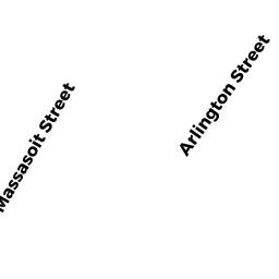
Single Family Residential owned by FELTEN DANIEL W & SARAH OSGOOD - 13 ARLINGTON ST
Two-Family Residential owned by PERRY DAVID B & CLARE W S - 15 ARLINGTON ST
Single Family Residential owned by SCHWEITZER WAYNE A - 8 FOURTH AVE
Single Family Residential owned by AINBINDER ALISA & THEODORE LEVENTHAL